SEPTEMBER 18, 1926

THE GREAT MIAMI HURRICANE

A DIGITAL EXHIBITION & ARCHIVE

Enter the Museum
Art Deco emblem showing the 1926 Great Miami Hurricane over downtown Miami, with wind-blown palms, warning flags, rough seas, and a dominant hurricane spiral

Museum preview

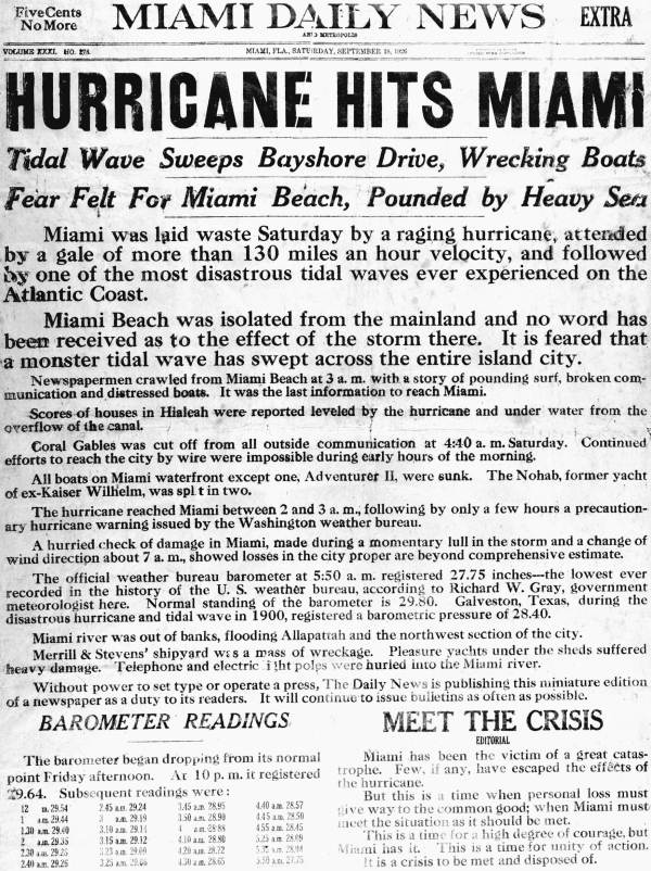
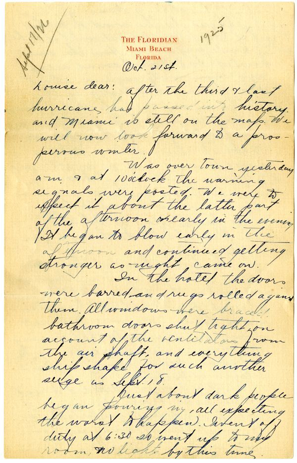
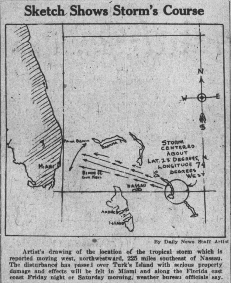
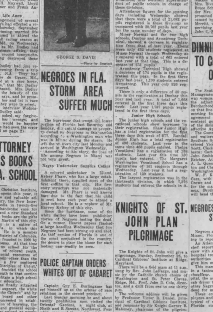
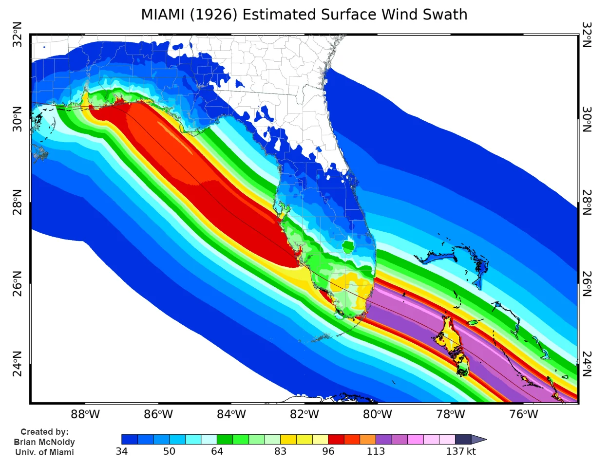
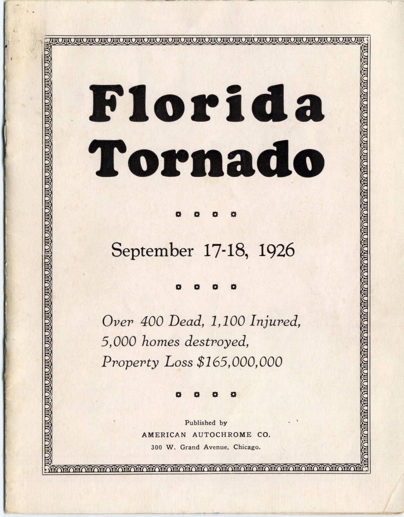
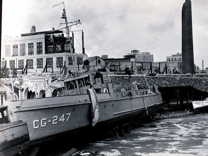
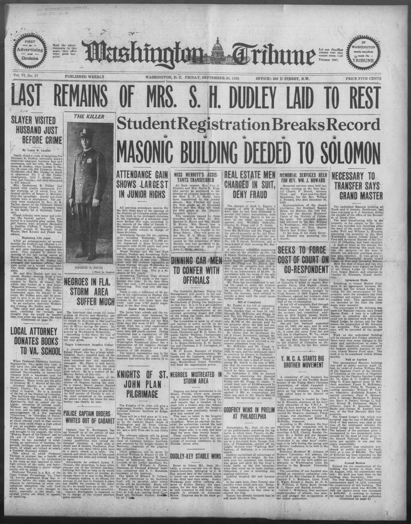
Miami Daily News Extra front page, September 18, 1926 First page of Kaye's hurricane letter Sketch Shows Storm's Course, a newspaper artist's 1926 hurricane map Washington Tribune headline: Negroes in Florida Storm Area Suffer Much Modeled 1926 Miami landfall wind field Florida Tornado September 17–18, 1926 pamphlet cover Coast Guard vessel CG-247 amid Miami hurricane wreckage Rose Mahoney hurricane damage view from the Alcazar Hotel

The boom before the barometer fell

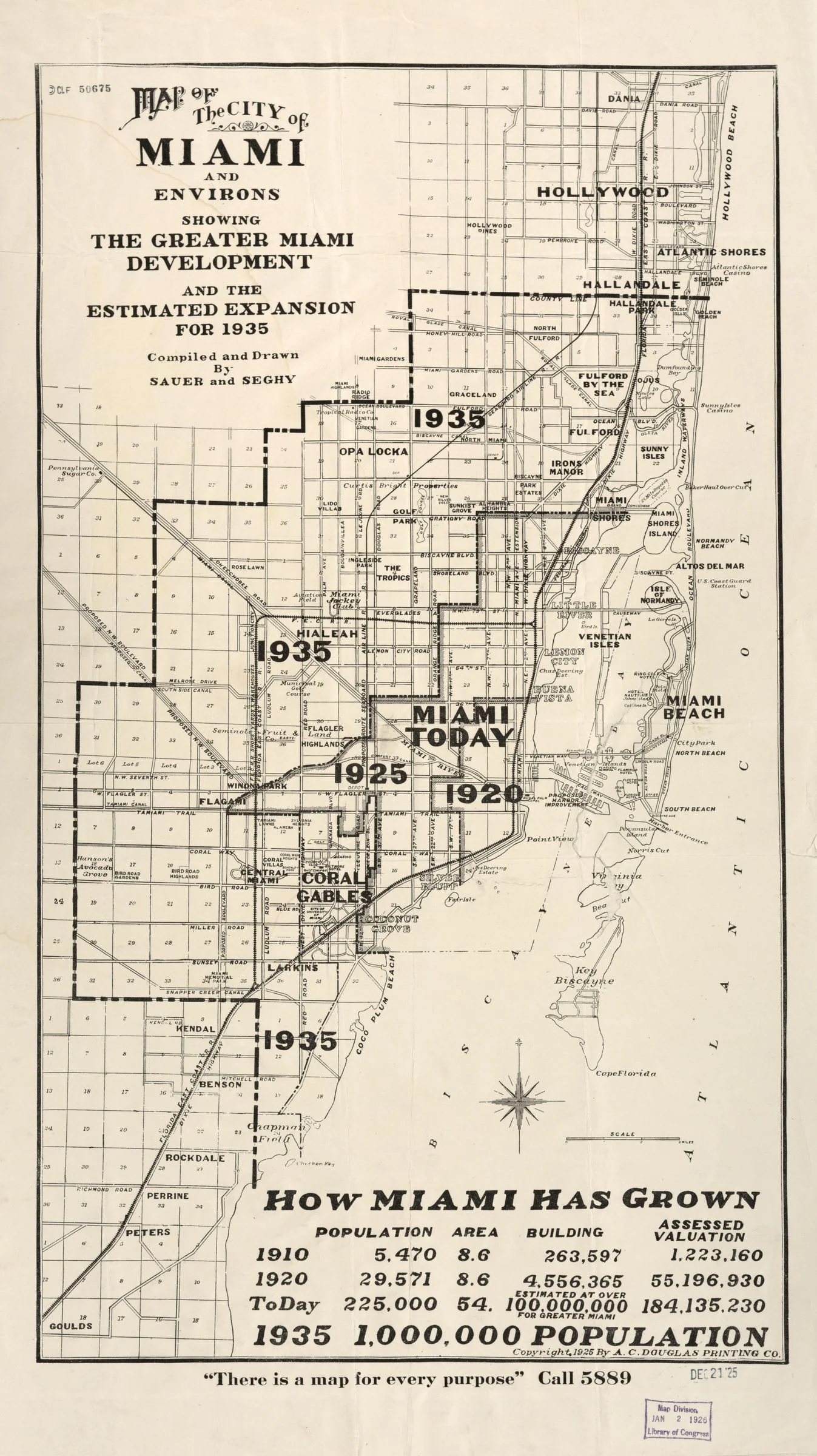
Miami’s promoters sold a city still taking shape. Streets, hotels and new subdivisions turned land into investments; a development map even pictured the city’s expansion to 1935. The boom crested in late 1925. By September 1926 the hurricane struck a property market already in retreat.

Continue the story

The Royal Palm’s grounds, downtown hotels, a park concert, a bank and Burdine’s show different parts of the city being promoted. Workers and families sustained the place behind those views. Open the full boom story to follow the shift from winter resort to land rush, and from speculative growth to the September disaster.

1926 contextThis was modernity on display. Automobiles, paved streets, large hotels, aerial photographs, new utilities and speculative subdivisions were not quaint remnants of an old Miami; they were evidence of a city changing with unusual speed only three decades after incorporation.
The night the city changed

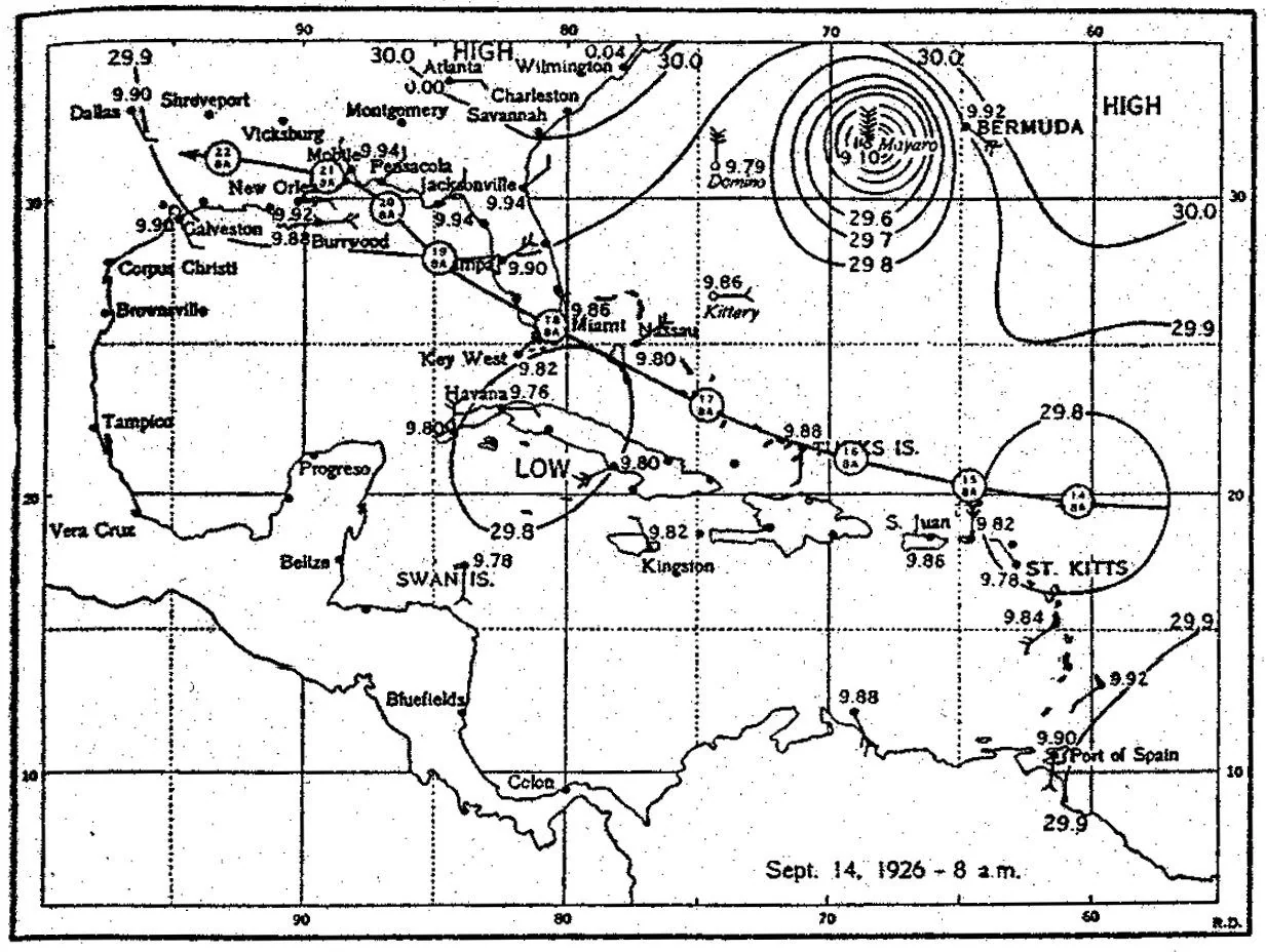
The September 17 and 18 weather charts follow the storm toward South Florida. After the first violent winds, the eye brought a deceptive interval of calm. The returning wind exposed people who had left shelter. Floodwater and wreckage made the waterfront dangerous long after the center passed.

Open A changing wind, a rising sea

The weather charts and the sea-wall photograph record different scales of the same event: the movement of a storm across the region and the damage at an individual site. The calm eye did not end the danger. After its passage, wind returned from a different direction and water carried wreckage through places that had been streets and gathering points.

Meteorology in 1926“Category 4” is a modern label applied after the fact. The Saffir-Simpson scale did not exist in 1926, and Atlantic hurricanes did not yet receive the familiar personal names used today. Residents heard terms such as storm warning and hurricane warning, watched signal flags, followed falling barometers, and depended on Weather Bureau bulletins, ships, telegraph, radio and newspapers.

Richard Gray & the Weather Bureau

Richard Gray’s Miami office left a written record of the storm. Read the observation sheets beside the barograph: one describes conditions in words and numbers; the other traces pressure as the hurricane approached and passed. These station observations describe a particular place, while the reconstructed track follows the storm’s center.

Continue the story · Hurricanes 101

The pressure trace can be followed across the passage of the storm without treating every value as a measurement at the hurricane’s center. An instrument describes its own exposure and location. Gray’s written observations add what a line alone cannot show: conditions around the office and the sequence in which the danger developed.

How forecasters knewThere was no satellite picture, weather radar or routine aircraft reconnaissance. The Weather Bureau learned about the hurricane mainly from scattered ship reports and surface observations. A falling barometer showed pressure dropping at one location; it did not by itself reveal the storm’s exact center, size or complete wind field. Modern track and intensity values therefore combine surviving observations with later scientific reanalysis.

Biscayne Bay, wreckage & witnesses

Vessels appear against bridges, buildings and streets in the surviving photographs. Their positions show the force of wind and water on a working waterfront. The Rose Mahoney material adds a different kind of evidence: a ship’s log and a newspaper account published in 1928, two years after the hurricane.

Continue the story

In the photographs, boats have become obstacles on land and wreckage along the shore. The bridge, shoreline and city skyline give the scenes their geography. The captain’s log offers a sequence of experience, while later newspaper coverage shows how that experience became a public story. Read the date and source of each before combining their accounts.

Miami Beach & storm surge

Miami Beach’s hotel district stood on a low barrier island between the Atlantic and Biscayne Bay. Photographs place the damage at the Roney Plaza, Pancoast and Casa Loma hotels, and along the County Causeway. The Wofford lobby brings the story indoors: the storm disrupted the spaces where visitors had expected comfort and shelter.

Hotels stand among the damaged streets and shorefront scenes. The commercial promise of a barrier-island resort placed buildings close to the water that made the location attractive. The Pancoast, Casa Loma and causeway views connect individual damage sites to the larger problem of reaching, sheltering and rebuilding the beach community.

1926 contextMiami Beach itself was still a young engineered resort city. Dredging, causeways, sewers, pumping stations and new hotels had rapidly transformed a low barrier-island landscape. The hurricane therefore struck infrastructure and real estate that, in many cases, had existed only a few years.

Downtown Miami & street damage

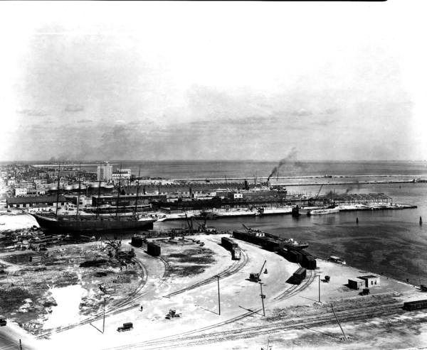
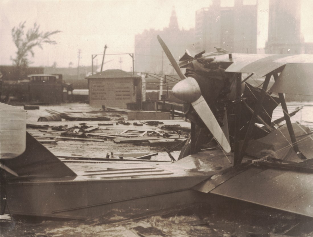
Downtown photographs move from the river to the commercial streets. The News Tower remains a recognizable landmark in a damaged city. An automobile on Northeast First Street, debris in the theater district and a damaged seaplane show how the storm crossed the boundary between water transport, streets and buildings.

The seaplane, riverfront and commercial-street photographs reveal a working city disrupted. Broken roofs and damaged vessels are only part of the scene; people, streets and surviving buildings show the setting in which immediate recovery began. Compare the views as separate locations, rather than assuming every photograph records the same block.

1926 contextThe automobile and seaplane were signs of a new transportation age. Commercial aviation was only beginning to develop into a dependable network, while automobile ownership was reshaping streets and commerce. Their wreckage recorded damage to technologies Miami associated with speed, mobility and the future.

Paper archive

Letters, newspapers and souvenir books recorded the hurricane for different readers. A letter carries one writer’s experience; the September 24 Miami Herald page belongs to the first week of recovery. Albums and printed picture books assembled scenes into a lasting record. Their captions and publication dates matter as much as the images.

Open Research library

A newspaper page gathers reports for a public audience. A letter addresses one recipient, and an album assembles a more personal memory. Their formats shape what is preserved: a headline, an explanation to family, or the arrangement of photographs. The full-page viewers retain that surrounding evidence rather than isolating a sentence or cropped detail.

Aftermath & memory

Damaged houses and fallen trees reveal work that could not be finished in a few days. A month later, another hurricane devastated Cuba. Miami’s Weather Bureau recorded that about 5,000 people left the city on October 20 after warnings were issued. The city was still responding to September’s disaster when the next threat arrived.

Continue the story

People appear on debris-filled streets beside damaged houses. These images move the story from the storm’s path to the work of living after it. Another hurricane warning in October brought a new wave of departures. The city’s physical recovery and the recovery of public confidence followed different timelines.

The missing marker
Interactive Timeline

SEPTEMBER 11–20, 1926

Select a moment to follow the hurricane from its first ship reports through warning, landfall, and recovery. The map advances to the matching official track fix.

Weather map accompanying the selected timeline moment

Sep 11

First known reports

The Weather Bureau first learned of the Cape Verde hurricane from ship reports in the central tropical Atlantic. This opening point establishes the long approach before South Florida understood the threat.

View matching HURDAT point
Storm Atlas · Official HURDAT2 Record

Track, intensity & evidence.

Follow all 46 official fixes, inspect documented wind reports, and move between regional views. Display winds use NHC-style five-mile-per-hour increments; missing fields remain unfilled.

Storm IDAL071926
Official plots46
Record spanSEP 11–22
Landfall fixes2
Focus
Layers
Historical atlas ready · optional evidence off
Plot 29 of 46 September 18, 1926 · 7:00 AM EST · source 12:00 UTC
Official fixCyclone: filled = hurricane · outline = tropical storm · dashed = depression1–5 = hurricane category Tropical storm Category 1–2 Major hurricane Intensity track Official RMW Documented hurricane-force (≥75 mph) Documented gale/TS-force (40–70 mph)

Reading the Miami close-up: track and city dots mark exact coordinates and have zero geographic radius; their fixed screen size is not miles. Thin leaders connect displaced city names to their dots. Turn on Miami inner core to see NOAA’s geodesic 20-nautical-mile radius of maximum wind and a cyan connector from the official 25.6°N, 80.3°W center to the downtown Weather Bureau, about 14 miles away. Gray recorded about 35 minutes of variable, much lighter wind downtown from roughly 6:10 to 6:45 a.m.; the record places Miami in or near the eye’s northern edge. HURDAT2 has no eye-size field, and that one station’s passage does not establish a precise circular eye diameter, so this atlas does not draw an invented eye boundary.

Original ship reports

Signals from the storm’s path.

Mitchell’s 1926 table preserves named vessel observations in their original reporting format. Beaufort values are retained without inferring an exact sustained wind.

DateVesselPositionPressureWindWeather
Sep 16 · 8 PMU.S.S. Kittery20.1°N, 72.3°W29.64 in.SW · Bft 6Cloudy
Sep 16 · 8 PMS.S. Gulf Trade24.3°N, 74.3°W29.82 in.NE · Bft 5Rain
Sep 17 · 8 AMS.S. Scantic26.3°N, 74.2°W29.90 in.E · Bft 7Partly cloudy
Sep 17 · 8 PMS.S. La Playa26.4°N, 79.7°W29.74 in.NE · Bft 6Cloudy
Sep 18 · 8 AMS.S. El Oceana29.3°N, 79.5°W29.66 in.NE · Bft 9Rain
Sep 18 · 8 AMS.S. Scantic25.7°N, 76.6°W29.88 in.SE · Bft 7Cloudy

Beaufort wind-force key · complete scale

Ship observers used wind force to describe conditions at sea. The modern National Weather Service equivalents provide context; they are ranges, not exact measurements of the 1926 winds.

ForceDescriptionModern speed range
0Calm0–1 mph
1Light air1–3 mph
2Light breeze4–7 mph
3Gentle breeze8–12 mph
4Moderate breeze13–18 mph
5Fresh breeze19–24 mph
6Strong breeze25–31 mph
ForceDescriptionModern speed range
7Near gale32–38 mph
8Gale39–46 mph
9Strong gale47–54 mph
10Storm55–63 mph
11Violent storm64–75 mph
12Hurricane forceOver 75 mph

National Weather Service Miami: complete Beaufort scale

Modeled wind footprint

The storm’s estimated surface-wind footprint.

Brian McNoldy’s reconstruction uses the hurricane’s track, intensity, radius of maximum wind and tropical-storm wind radii to estimate the strongest surface wind experienced across the region. Missing parameters and land roughness require assumptions, so the swaths and animation should be read as a physically informed reconstruction rather than an observed wind map.

Explore the reconstruction and sources
Weather Bureau Source Room

Richard Gray, warnings, barographs, and synoptic charts.

Official observation records and synoptic analyses support the expanded timeline and the “Inside the Eye” interpretive sequence.

These are contemporary U.S. Weather Bureau analyses published in the October 1926 Monthly Weather Review, not modern reconstructions. The surviving published sequence includes September 14, 15, 17 and 18; no September 16 plate appears in that article. Follow Miami’s observations hour by hour.

Focused Source Room

The voyages and wreck of the Rose Mahoney.

Explore photographs, the captain’s log and the later newspaper account of the Rose Mahoney. Each source opens with its caption and available collection information.

From ocean trader to Miami landmark.

Before she became a familiar wreck on Miami’s waterfront, the five-masted Rose Mahoney carried timber and coal between continents. A 1928 newspaper retrospective named San Francisco owner Andrew J. Mahony and said his daughter supplied the vessel’s name.

The schooner’s final voyage brought lumber from Seattle by way of San Pedro and the Panama Canal. She reached Miami in January 1926, unloaded for months, and then lay on the Miami side of the bay until the September hurricane drove her ashore.

By September 1928, the newspaper reported that her splitting hull would be dismantled. Later traditions place one mast at the Biltmore Hotel and another at Bayfront Park, but no contemporary record shown here proves either destination.

Miami Beach Source Room

MIAMI BEACH, STORM SURGE, AND BARRIER-ISLAND PHOTO REFERENCES.

A curated Miami Beach room tied to the timeline’s backside strike and surge phase. These images emphasize beachfront hotels, damaged houses, palms, causeway views, and the barrier-island landscape after the hurricane.

Downtown Miami Source Room

DOWNTOWN MIAMI, STREET DAMAGE, AND PUBLIC-SAFETY AFTERMATH REFERENCES.

A downtown room tied to the city-center aftermath: wide downtown and river scenes, street-level views, and interior public-safety aftermath.

Paper Archive

REPORTING, CORRESPONDENCE, AND PRINTED MEMORY.

Read the storm first through contemporary reporting and personal accounts, then through the albums and picture sets that shaped how the disaster was remembered.

Contemporary reporting & correspondence

Newspaper pages, letters and manuscripts preserve different kinds of evidence: public headlines, private description and first-hand recollection.

Albums & published picture memory

Albums and picture sets rearranged the storm into sequences for later viewing. They remain separate from the immediate newspaper and correspondence record.

Library Shelf

BOOKS AND PUBLISHED PICTURE VOLUMES.

Four published volumes preserve photographs and accounts of the hurricane. Open a cover to turn through the complete surviving sequence.

Living Memory

Two stories that carry the hurricane into the present.

A missing public marker and a recorded eyewitness account carry the hurricane into the present.

A missing piece of memory

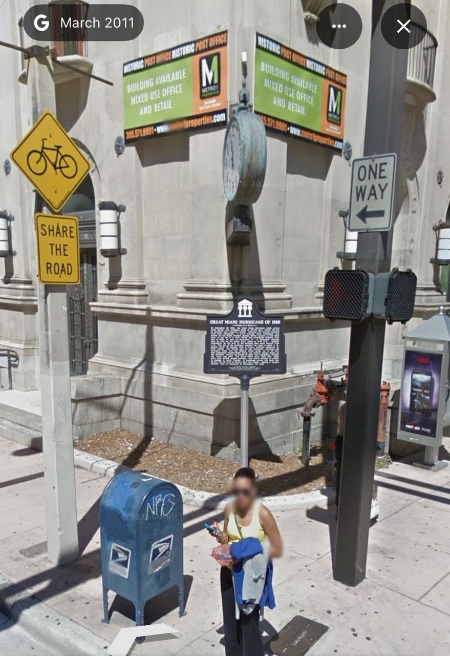
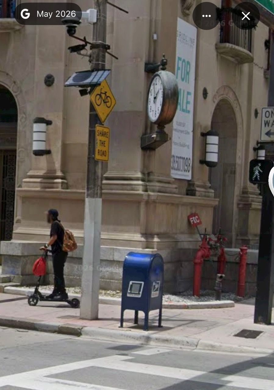
Where is Miami’s hurricane marker?

The hurricane marker outside the Old Federal Building in March 2011The same Old Federal Building corner without the marker in 2026

The marker stood outside Miami’s former Weather Bureau building in 2011 and was gone by 2014. Photographs, reporting and correspondence trace the disappearance and the renewed replacement effort.

2007Dedicated2011Still present2026Replacement underway
The missing marker
02
Meteorologist Rob Jones interview archive

Wilbur Jones remembered Coral Gables

Born in 1912, Wilbur Jones was about fourteen when the hurricane struck while his family lived in Coral Gables. In this archival interview recorded by Meteorologist Rob Jones around 2013–14, he recalls early Miami, Coral Gables, the storm, and its aftermath.

The excerpt is lightly edited to retain the portions concerning Miami and the 1926 hurricane. Unrelated material was removed, and simple fades connect the surviving interview segments; no narration or historical reconstruction was added.

Watch on YouTube ↗Read the FSU account of the 1997 interview ↗
University of Miami

THE STORM THAT HELPED NAME THE HURRICANES.

The university opened in 1926 as Miami reeled from the storm. Hurricane language soon became part of its athletics, student journalism and yearbook identity.

  1. A damaged boomtown: the storm struck as the new institution began its life in Coral Gables.
  2. Hurricanes: the name connected the school to the defining local event of its first year.
  3. Ibis and newspaper: the yearbook, mascot tradition and student newspaper carried the identity forward.
Selected collections

Explore the collections.

Browse selected photographs, maps, weather records, manuscripts and books in the image viewer. Newspaper reading room or Research library.

Showing archive records.

Curated Exhibit

Explore the storm, room by room.

Eight rooms move from the fever of boomtime Miami through warning, landfall, survival, and remembrance. Each pairs concise interpretation with a source visitors can enlarge and inspect.

Meteorology Matters Podcast

The Great Miami Hurricane — 100 Years Later

Moving Image Archive

Watch surviving motion pictures.

Hurricane Disaster at Miami

120 Mile An Hour Hurricane

Miami Beach before the storm

Filmed during the hurricane

The 1926 Hurricane Library

Read the records. Follow the evidence.

Explore contemporary accounts, books, photographs and later research.

Cover of Florida Tornado, September 17–18, 1926

Florida Tornado, September 17–18, 1926

American Autochrome Company, Chicago, 1926. University of Miami Libraries preserves the eight-page pictorial pamphlet documenting hurricane destruction in Miami and Miami Beach.

Open the locally preserved pamphlet set

The West Indian Hurricane of September 14–22, 1926

Charles L. Mitchell, Monthly Weather Review 54(10), pages 409–414. The contemporary Weather Bureau report brings together observations, ship reports and the storm’s progress.

Read the report
Washington Tribune headline Negroes in Florida Storm Area Suffer Much, September 24, 1926

Work or Jail — Black Miami

The exhibit follows the Ward family confrontation, compelled cleanup labor, Black-press investigation and Hialeah's Colored Tent City through contemporary reporting, testimony and official records.

Open Work or Jail — Black Miami
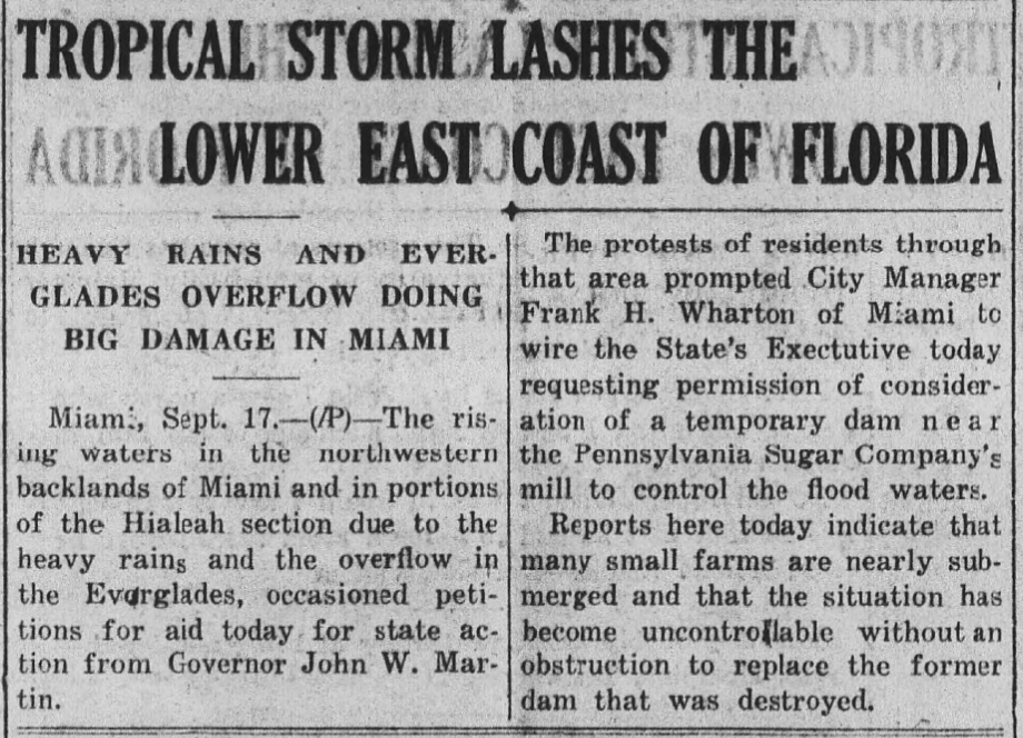
Contemporary newspaper clipping reporting Everglades overflow in Hialeah and northwest Miami

The ground was already wet.

Before the Great Miami Hurricane arrived, another cyclone, a measured September 16 cloudburst, Everglades overflow and a Broward dike break formed a second disaster story at the urban edge.

Open Storm 6: rain, flooding and the dike reports
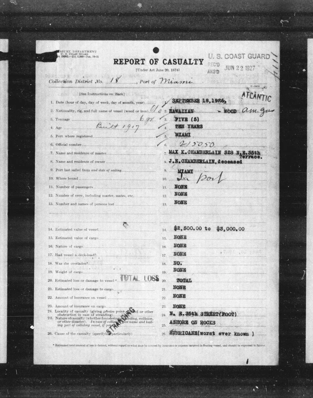
Max Chamberlain Coast Guard casualty report documenting an uninsured total loss

Who actually recovered?

A class-and-recovery dossier compares the visible rebuilding of hotels and tourist districts with the longer struggle of homeowners, renters, wage workers and segregated Black neighborhoods.

Open Wealth and recovery
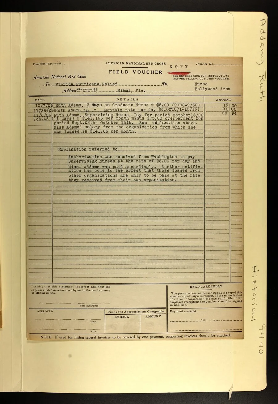
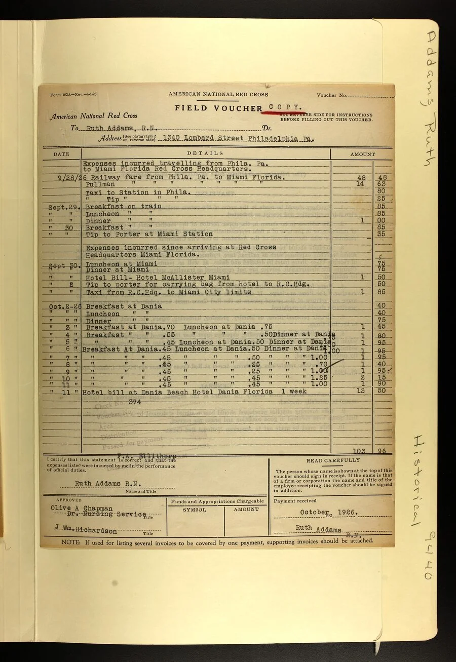
Ruth Addams Red Cross salary voucher for the Hollywood area

Relief work, page by page.

Sixteen original Red Cross pages document Ruth Addams's travel, lodging, Hollywood-area assignment, promotion, illness and struggle to settle her final pay and expenses.

Ruth Addams: hurricane relief
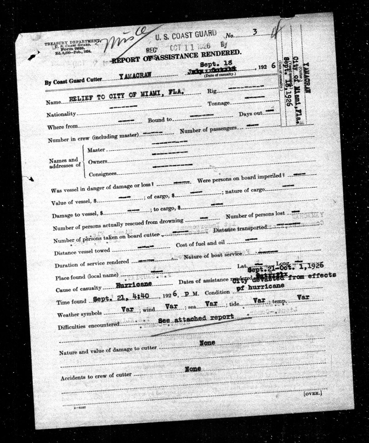
U.S. Coast Guard Relief to City of Miami report

Relief began as survival work.

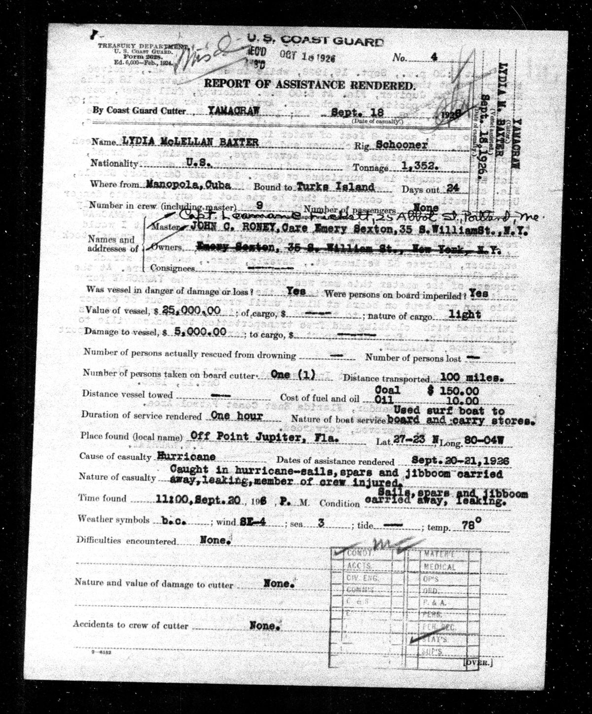
Ten original Coast Guard pages document policing, hospital transport, food and water missions, medical evacuations, and a later Red Cross expedition to Grand Bahama.

Coast Guard hurricane relief
1925 Miami development map illustrating the scale of the land boom

The boom was already faltering.

The hurricane struck after speculation, credit stress and transportation constraints had already begun weakening the Florida land boom. Vanderblue’s 1927 analysis helps separate those pre-storm economic pressures from the destruction and disruption that followed landfall.

Read Vanderblue’s 1927 analysis ↗
Thumbnail of Kaye's October 21, 1926 letter from the Floridian Hotel, State Archives of Florida

October warnings — and Kaye’s account.

Kaye’s October 21 letter from the Floridian Hotel recalls the September catastrophe and describes renewed preparations as another hurricane warning reached Miami Beach. The complete 24-image State Archives record is now preserved locally with a readable, verified on-screen transcription.

Open Kaye’s hurricane letter
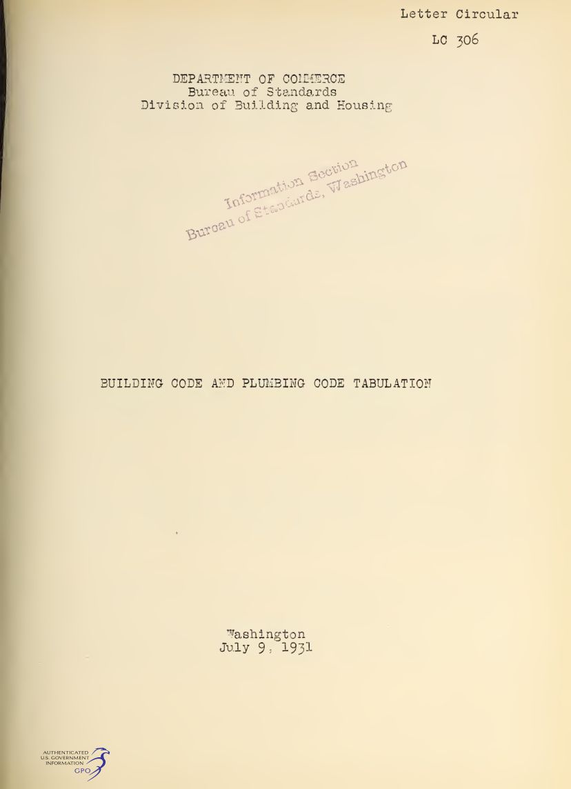
1931 U.S. Bureau of Standards Building Code and Plumbing Code Tabulation title page

How construction changed.

Miami already had building regulation before 1926, and Miami Beach reported an adopted and actively enforced code during the hurricane year. The disaster intensified inspection and reform rather than creating building codes from nothing; later regional standards developed through a longer post-storm history.

Open the federal building-code comparison
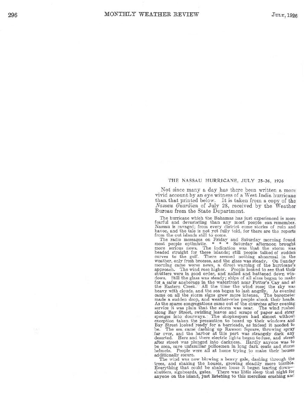
Headline and opening text of the Monthly Weather Review report on the Nassau hurricane of July 25–26, 1926

Warnings before September.

The September disaster did not occur in an otherwise quiet season. A destructive July hurricane had already struck the Bahamas, and contemporary Weather Bureau reporting documented the warning process, damage and public response months before the Great Miami Hurricane.

Read the July 1926 storm context
Damaged seaplane and waterfront wreckage in downtown Miami after the hurricane

What a modern loss estimate means.

The newest peer-reviewed normalization, published in 2026 using 2023 exposure, estimates about $243 billion under a housing-unit method and $288 billion under a population method. These are exposure-normalized historical losses, not simple inflation conversions or catastrophe-model forecasts.

Open Damage methodology

Research library

Browse the complete publications and source catalog