Underwood & Underwood · vertical mapping flight

1925 aerial survey

This was not a handful of scenic airplane views. It was a systematic photographic survey: a gridded record of Miami, Miami Beach and Dade County on the eve of the 1926 hurricane.

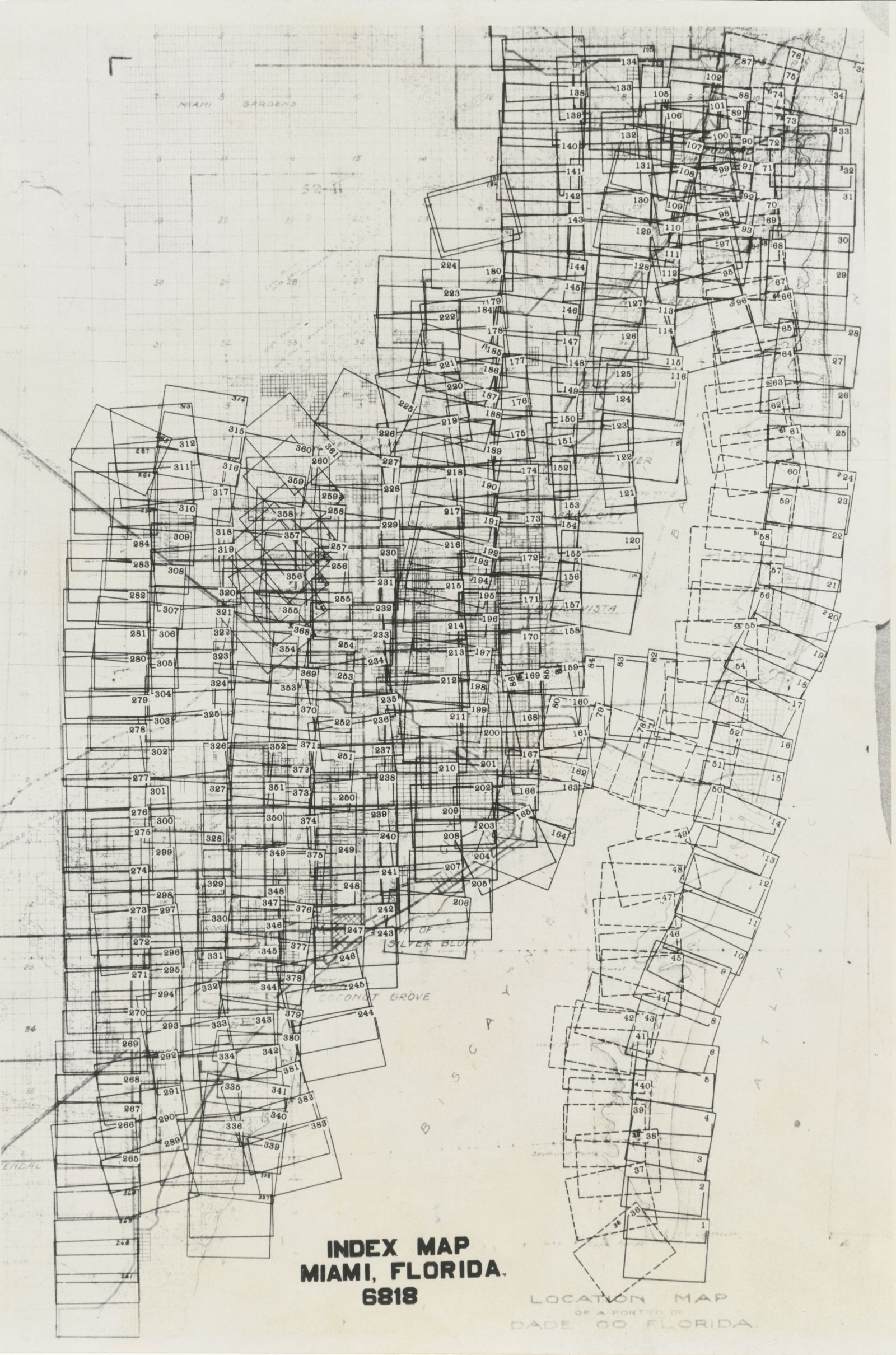
Survey scope: The Miami-Dade Public Library System online collection contains 342 surviving survey objects—the index map plus 341 photographic frames. The survey numbering runs from frame 002 through frame 383. The Miami-Dade Public Library System catalog explicitly identifies 38 missing numbers; three more numbers are absent from the online compound-object sequence. Those 41 frames are absent from the available sequence.

Index map for the 1925 aerial photographic survey of Dade County
Index Map Miami, Florida 6818. Select it to inspect the flight layout at full exhibit resolution.
What the series adds

A baseline before destruction

Vertical frames can document street grids, canals, mangrove and wetland margins, dredged islands, farms, subdivisions and the line where urban construction met the Everglades. Compared with post-storm aerials, they can help distinguish what the hurricane damaged from what had not yet been built.

The library dates the survey to 1925 and credits Underwood & Underwood. The locally served images retain repository credit and link back to the complete institutional record.
MDPLS complete record ↗
1924 or 1925? · two institutional descriptions

The dating conflict is part of the evidence.

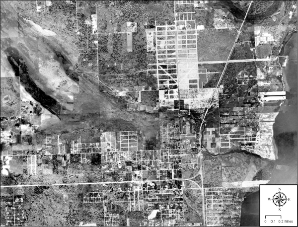
FIU composite of 1924 aerial photographs over Miami's Little River area
FIU’s Little River composite, described by the university as a series of 1924 aerial photographs.

Two catalog dates

FIU’s Miami-Dade ULTRA project describes aerial photographs taken over Miami in 1924 and assembled into a georeferenced mosaic. Miami-Dade Public Library catalogs the Underwood & Underwood compound object as 1925. The two institutional descriptions may refer to the same survey, adjacent work or different generations of copy, so this exhibit preserves both dates.

FIU’s interpretation is especially valuable for the flood story: its Little River mosaic shows transverse glades feeding the river and homes placed on higher ground beside freshwater drainage features. That is physical evidence of how close wetland hydrology remained to urban settlement.

FIU aerial-photography project ↗
Companion aerial view · circa 1923

Dredging had already remade Biscayne Bay.

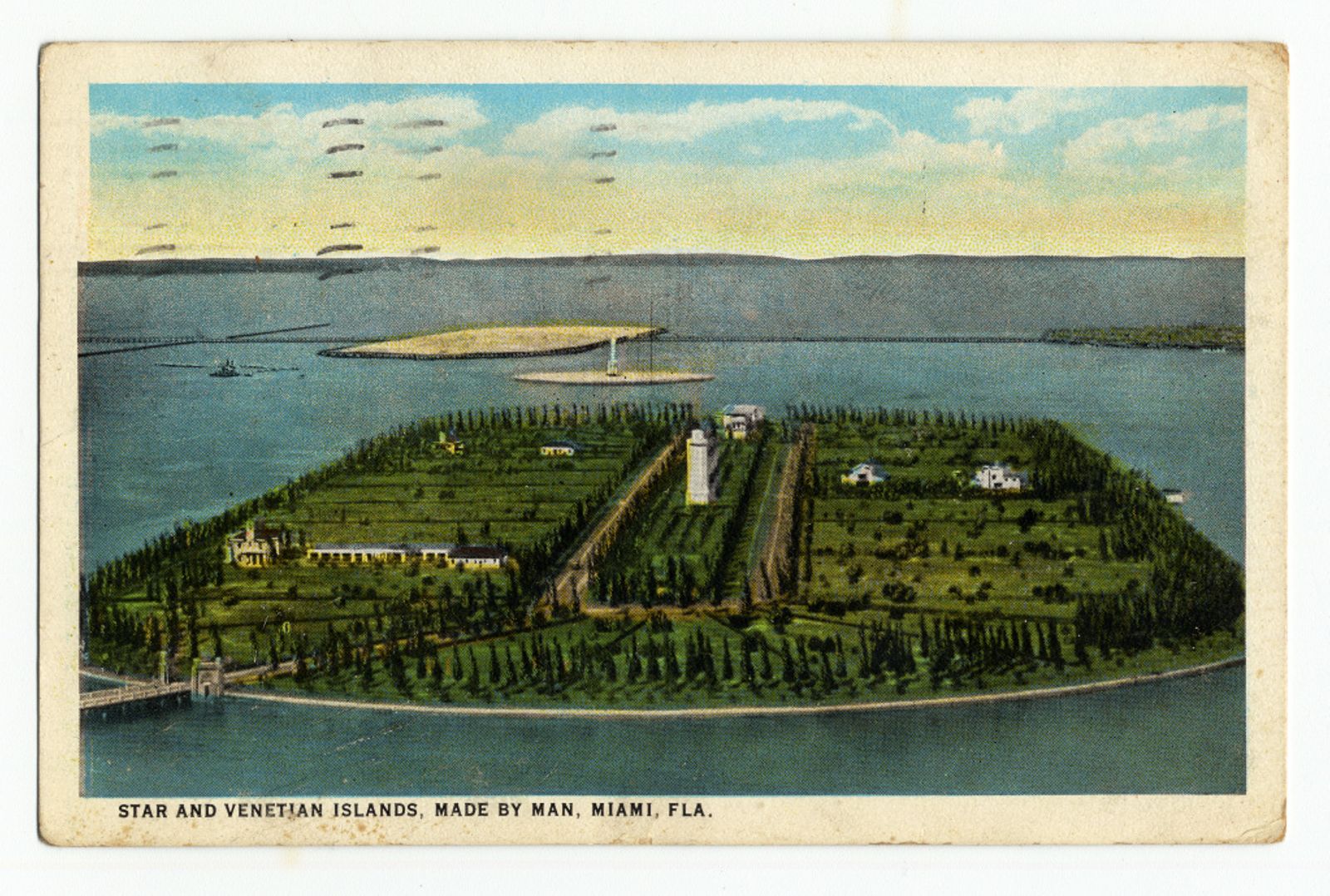
Aerial postcard view of the Star and Venetian Islands in Biscayne Bay around 1923
“Star and Venetian Islands, made by man, Miami, Florida,” circa 1923 and postmarked February 1924. University of Miami Libraries, Florida Postcard Collection.

Engineered shoreline before 1926

The University of Miami record describes this aerial postcard as a view of the artificial islands created through Biscayne Bay dredging. The locally preserved image retains repository credit and a link to the institutional record.

The image adds an important pre-hurricane baseline: the metropolitan shoreline was already an engineered landscape of dredged islands, causeways and development before the 1926 storm tested it.

University of Miami source record ↗
Native survey gallery

Explore the surviving flight frames

Loading frame catalog…
Show the 41 absent frame numbers

007, 014, 094, 103–104, 117–119, 135–137, 171–173, 181–183, 224, 260–264, 285–288, 303, 313–314, 323, 325, 337–338, 352 and 362–367.

Evidence & limits

What the frame numbers do—and do not—tell us

The online object supplies frame labels but not a street-by-street caption for every negative. The index map is therefore essential: each frame is presented with its survey number, while geographic identifications are limited to what the layout and visible landmarks support.

Source: Miami-Dade Public Library System, Helen Muir Florida Collection, “Aerial photographic survey of Dade County, Florida,” Underwood & Underwood, 1925, digital identifier mdplflafm202206270001. Download the local collection metadata.