1926HURRICANE.COMSeptember 16–17, 1926 · Before the Great Miami Hurricane
Storm 6: rain, flooding and the dike reports
Miami recorded 1.20 inches of rain in 45 minutes on September 16. By September 17, a wire report described flooded farms in Hialeah and northwest Miami. A separate weak cyclone was fading nearby while the Great Miami Hurricane approached.
Two cyclones, one crowded forecast
Storm 6 was leaving as Storm 7 approached.
Official reanalysis
The earlier system
NOAA’s HURDAT reanalysis identifies a separate unnamed cyclone as
1926 Storm 6. It crossed Cuba, briefly reached minimal
tropical-storm strength near the Bahamas on September 15–16,
passed through the Florida Straits during the night of September
16–17, and weakened to a depression.
Miami station record
The local rain burst
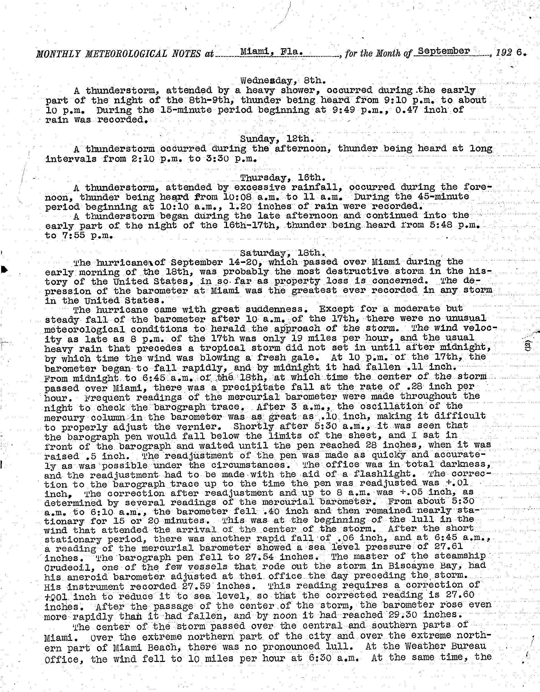
Richard W. Gray recorded 1.20 inches at Miami in only 45 minutes,
from 10:10 to 10:55 a.m. on September 16, and called the rainfall
excessive. Thunder returned from 5:48 to 7:55 that evening.
This overlap helps explain why the public story can look confused in
retrospect: local rain and inland flooding were already under way
while a much more dangerous hurricane was approaching from the
southeast. The earlier system’s presence is documented; assigning
every flooded field to that cyclone alone would go beyond the
evidence.
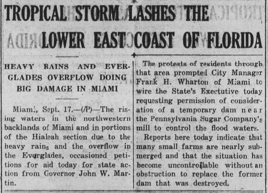
Associated Press dispatch dated September 17: rising water in
northwest Miami and Hialeah, nearly submerged small farms, and a
proposed temporary dam near the Pennsylvania Sugar Company mill.
The crop preserves an Associated Press dispatch; its newspaper
masthead is outside the surviving image.
The report describes residents seeking state action from Governor John
W. Martin and Miami’s city manager asking permission to consider a
temporary control structure. That is more than background rain: it
shows a city trying to manage water moving across a shared
agricultural, canal and urban system before hurricane winds arrived.
North of Miami
A dike break exposed the regional problem.
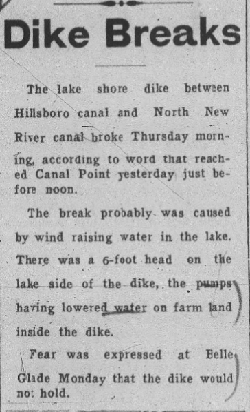
The clipping reports a lake-shore dike break between Hillsboro
Canal and North New River Canal, a six-foot head on the lake side,
and earlier fear at Belle Glade. The crop does not preserve its
newspaper masthead.
What it adds—and what it does not
The report broadens the geography beyond Miami and Hialeah into
the canal-and-dike system connecting Broward and the Lake
Okeechobee region. It is evidence of regional water-control
stress. Until the complete newspaper page is identified, the
exhibit does not assign the breach to one cyclone or claim the
clipping proves the precise time of failure.
Two storms in the same week
Why the accounts can be confused
Storm 6 and the Great Miami Hurricane were separate cyclones. NOAA’s revised catalog numbers the weaker system as 6 and the Miami hurricane as 7; the older entries reproduced in the same record use the opposite numbers. A number alone can therefore identify the wrong storm when comparing sources.
Storm 6 crossed Cuba and briefly reached minimal tropical-storm strength near the Bahamas on September 15–16. NOAA found no apparent tropical-storm conditions in southeast Florida from this system. Its presence, Miami’s measured rain and the flood reports overlap in time, but that does not establish that it caused every flood or the undated dike breach.
For a modern reader, the overlapping dates and changing storm numbers make the sequence easy to merge. Establishing what residents understood at the time requires their actual warnings and newspaper accounts.
The city and the Everglades shared one water system.
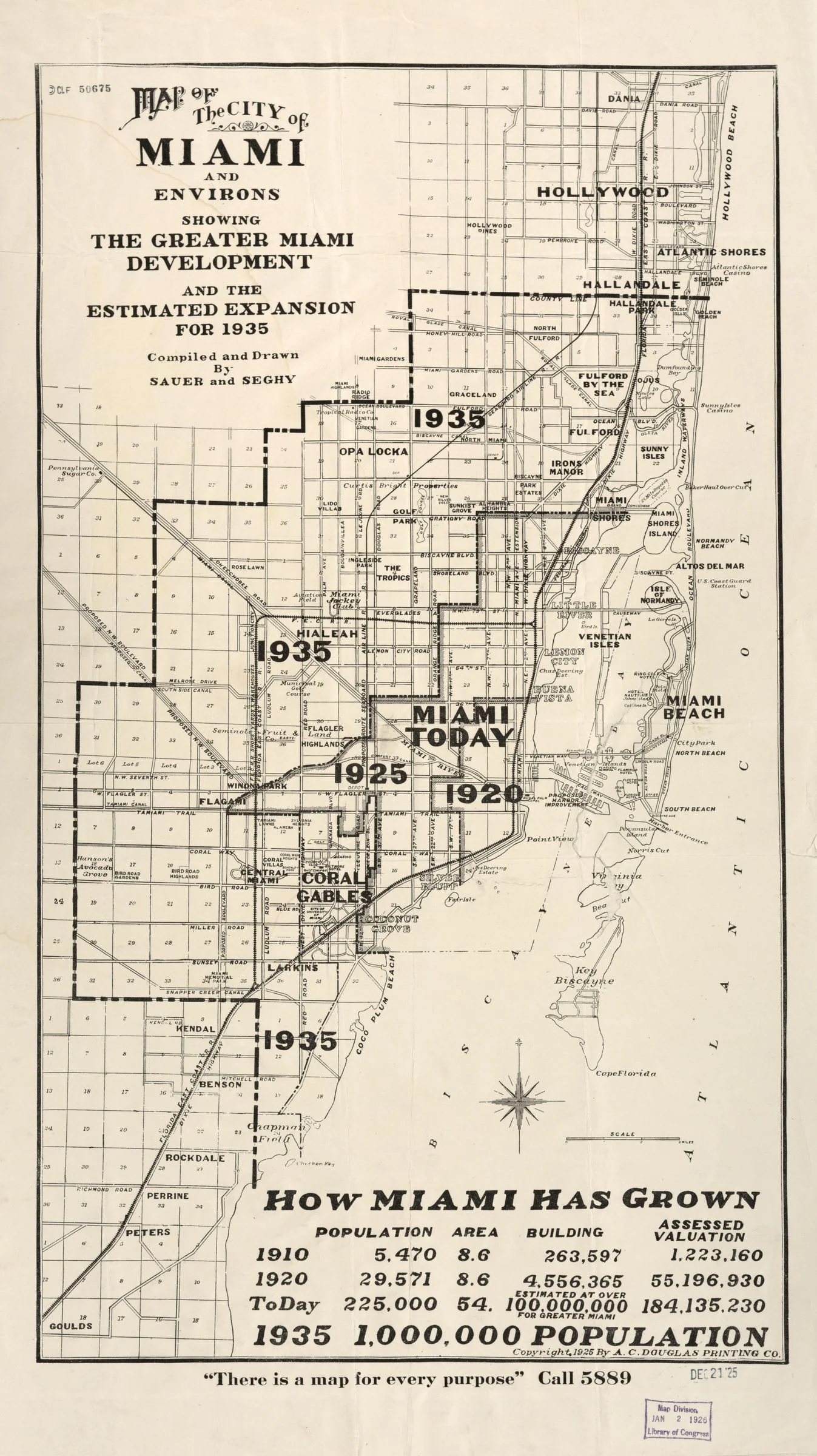
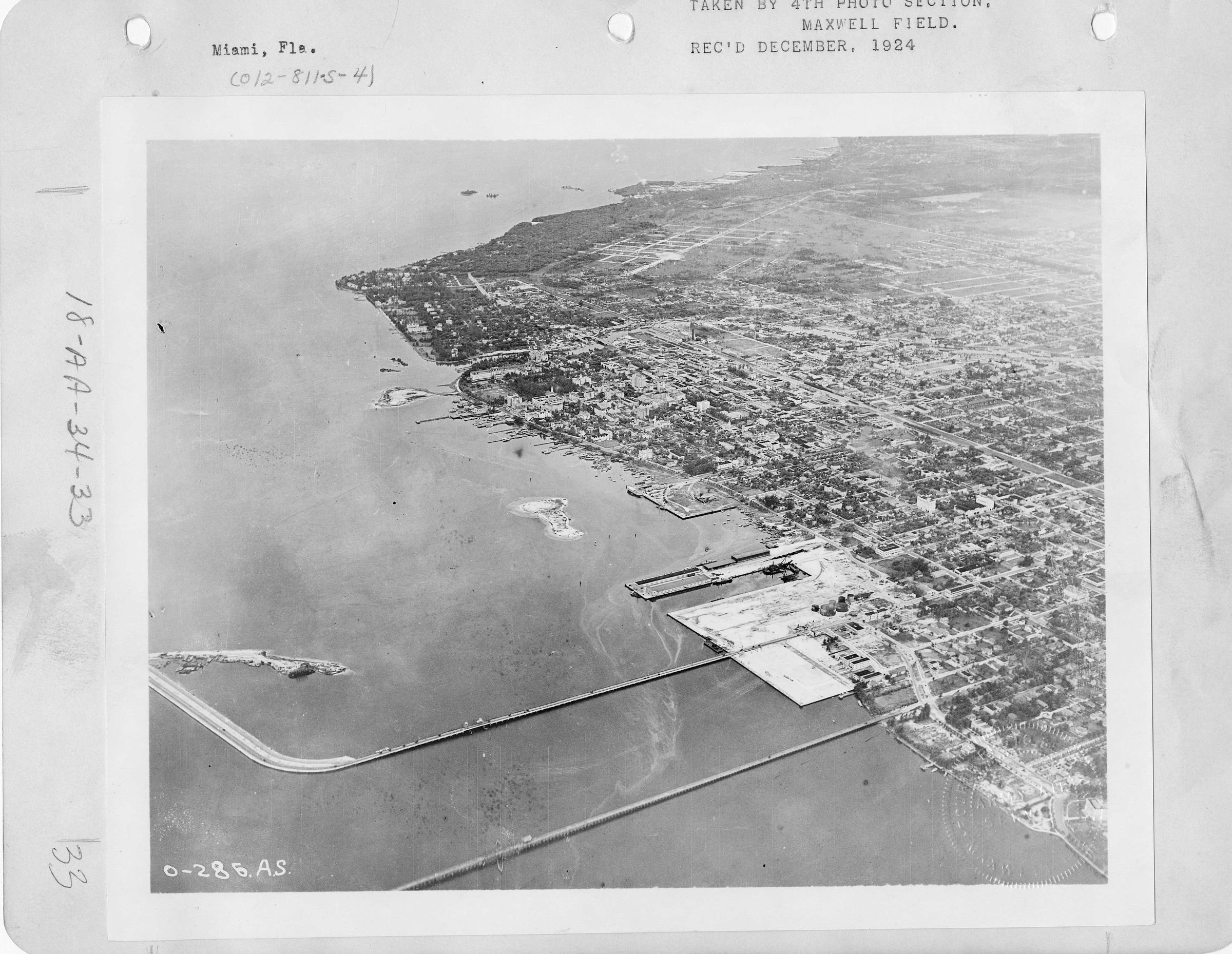
The 1925 development map and December 1924 aerial view show why “the
Everglades” cannot be treated as a distant wilderness in this story.
Subdivisions, roads, farms and drainage canals reached west from the
coastal ridge into low land. The evidence does not show the marsh
physically retreating on its own; it shows people extending the urban
and agricultural edge into a landscape whose water had been redirected
but not eliminated.
1925 development map. Read it as evidence of the metropolitan
footprint, not as a hydrologic survey.
December 1924 aerial view: the fast-growing city before the
September 1926 disaster.
Gray’s official notes anchor the September 16 rain burst to a
measured time and amount.
Together these sources establish urban proximity, rapid development
and measured rainfall. They do not, by themselves, establish which
canal or drainage work caused each reported flood.
The 1976 National Register nomination is later documentation, but it
identifies the Everglades Drainage District, the canal builders and
the surviving minutes used to reconstruct the system. It also records
1926 as the year shoaling and new road and rail links ended practical
boat traffic through Lock No. 1.
 1926HURRICANE.COM